“Forever kept as wild forest lands”
A story behind the making of the Adirondack Forest Preserve
This four-part series is based on research from the summer of 2023 funded by the Program for Undergraduate Research. Sam spent time both at Bucknell and in the Adirondacks with the guidance of Professor Claire Campbell.
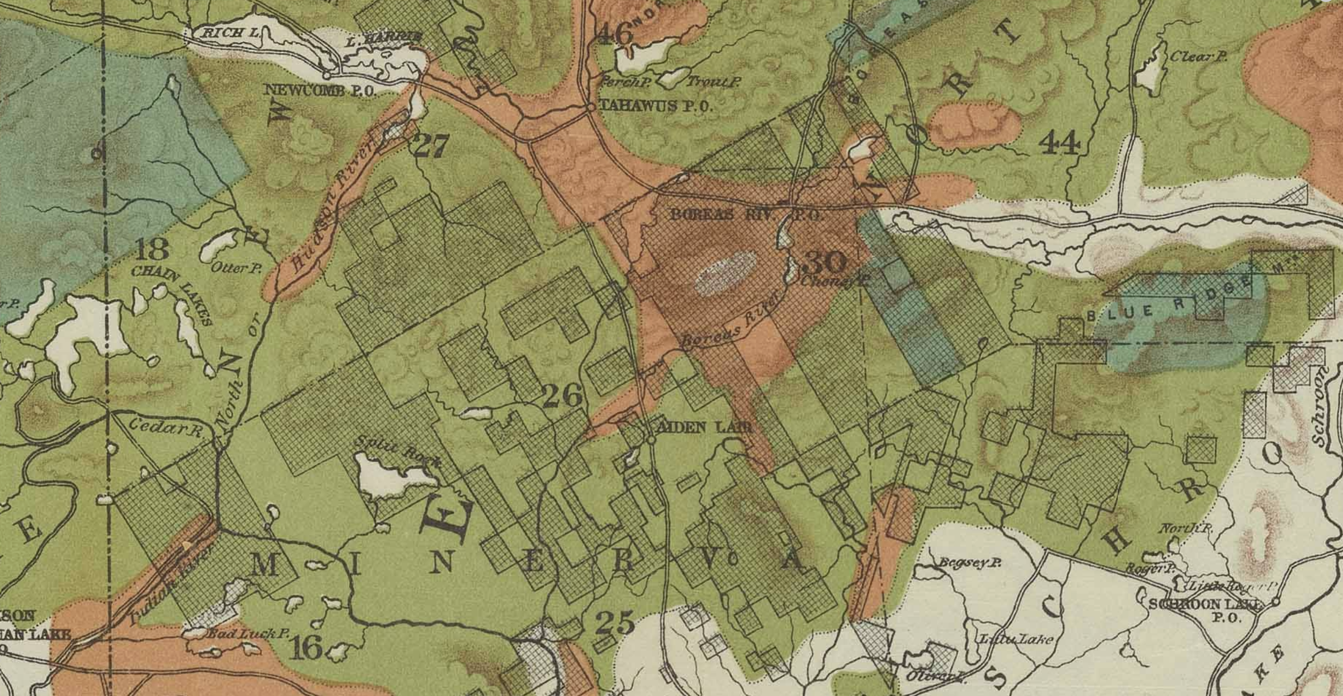
“Map of the Adirondack Plateau showing the position & condition of existing forests.” (A. Robeson, 1884. Courtesy of the Adirondack Experience.)
In January 1884 the New York State Senate received a report on state lands from a special committee on state lands in the Adirondack region.1 According to the report, between 1873 and 1883 New York State went from owning 38,854 acres of land to 750,616 acres of land, almost entirely on the Adirondack Plateau. The state had acquired this land, in some ways, unintentionally, through unpaid taxes.2 (Logging companies were harvesting the trees, not paying their taxes, and then – after five or ten years – letting the state acquire their land to cover the unpaid taxes.)3 The state now owned all of this “valueless” and barren land, and needed a system of managing it. It was deemed not suitable for agriculture due to its rocky/sandy soil and long winters; the forests were, presumably, the only value.4
This map, created under the Forestry Commission in 1884, shows these regions of land that were destroyed by loggers and then sold to the state. This image includes the region from Newcomb and the Essex Chain of lakes in the West to Schroon Lake in the East with the Hudson River and Boreas River in the center, just south of the high peaks.
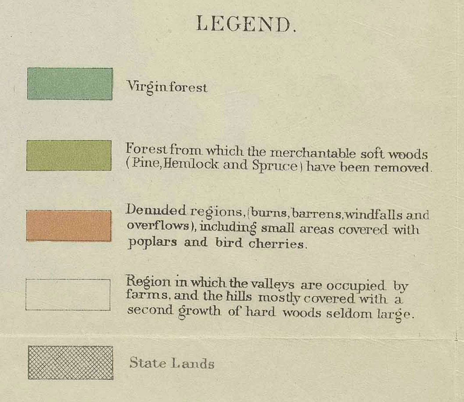
Map of the Adirondack Plateau showing the position & condition of existing forests. The legend (right) shows virgin forest (dark green), logged forest from which merchantable soft woods like pine, hemlock, spruce removed (yellow-green), and completely denuded regions (orange).
A. Robeson, 1884. Courtesy of the Adirondack Experience.
That year, the state legislature set aside $5,000 to the comptroller “for the employment of such experts as he may deem necessary to investigate and report a system of forest preservation.” Over the next year the new Forestry Commission – including Professor Charles Sprague Sargent of Harvard University, D. Willis James, a businessman of New York City, Edward Shepard, an attorney from Brooklyn, and Hon. William A. Poucher, a judge from Oswego – made various trips to the Adirondack Plateau “to report a system of forestry.” They presented their report to the state legislature on January 23, 1885, a year after the legislature learned of the massive amount of land now in state hands. Within a year, the legislature passed various laws to create the forest preserve – the exact laws that were proposed by the report in 1885. This was a remarkable arc of exploration and action within two short years in American environmental history. This course of events begs the question: are the Adirondacks exceptional? What made this possible?
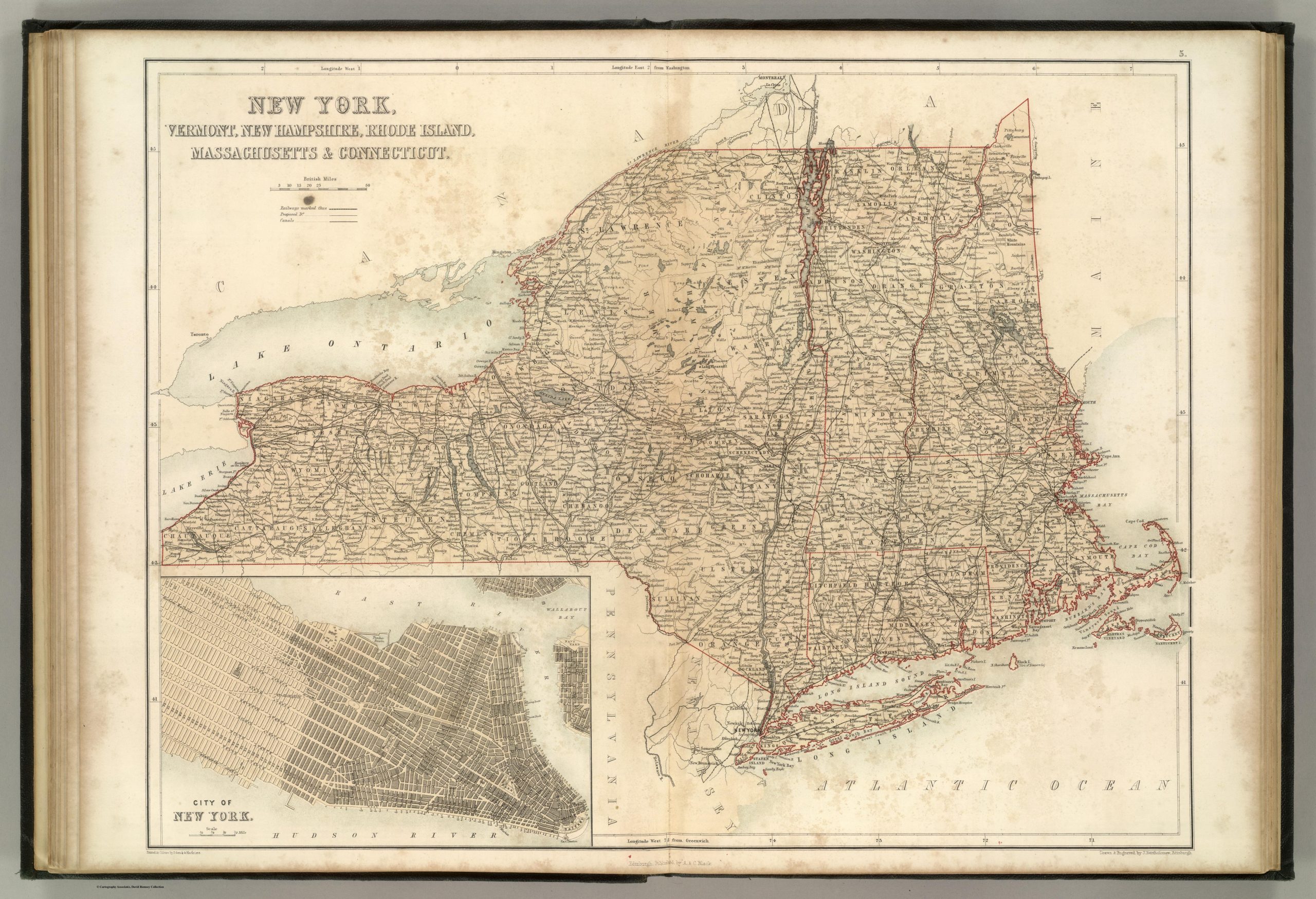
“New York, Vermont, New Hampshire, Rhode Island, Massachusetts & Connecticut.”
Published by A. & C. Black. Edinburgh. 1856. Printed in Colours by Schenck & Macfariane. Edinburgh. Drawn & Engraved by J. Bartholomew, Edinburgh. See full details from the David Rumsey Historical Map Collection.
About the Author
This four-part series by Sam Lasher (History and Political Science, ’25) is based on research from the summer of 2023 funded by the Program for Undergraduate Research. Sam spent time both at Bucknell and in the Adirondacks with the guidance of Professor Claire Campbell. Special thanks to the Adirondack Experience for assistance and archival material.

Sam Lasher
History and Political Science, ’25
Your articles are extremely helpful to me. Please provide more information! http://www.ifashionstyles.com
Thank you for your help and this post. It’s been great. http://www.hairstylesvip.com
May I request more information on the subject? http://www.kayswell.com All of your articles are extremely useful to me. Thank you!
Thank you for writing this post! http://www.kayswell.com
Hi there, You’ve done an excellent job. I抣l certainly digg it and personally suggest to my friends. I’m confident they will be benefited from this web site.
Good shout.
Nice
Nice
microdosing edibles area 52
snow caps area 52
thc gummies for anxiety area 52
thc gummies for pain area 52
best pre rolls area 52
sativa gummies area 52
live rosin gummies area 52
best sativa thc carts area 52
thc oil area 52
mood thc gummies area 52
live resin area 52
live resin gummies area 52
live resin carts area 52
thc sleep gummies area 52
hybrid disposable area 52
distillate carts area 52
thc tinctures area 52
indica vape area 52
where to buy thca area 52
shrooms area 52
infused pre rolls area 52
best disposable vaporizers area 52
thc gummies
indica gummies area 52
thca diamonds area 52
full spectrum cbd gummies area 52
thcv gummies area 52
thc vape area 52
weed pen area 52
thca gummies area 52
liquid diamonds area 52
liquid thc area 52
thca companies area 52
hybrid gummies area 52
Google Analytics Alternative